News & Media > Media Releases and Statements > Farm Transparency Map expands globally
Farm Transparency Map expands globally
 View as a PDF
- Interactive online map pinpointing the locations of thousands of slaughterhouses and factory farms across Australia launched in 2019
- The 'Farm Transparency Map' triggered widespread outrage and hysteria amongst conservative politicians and media outlets, who labelled it an "attack map"
- The crowdsourced tool has now expanded worldwide, with over 76,000 facilities already identified
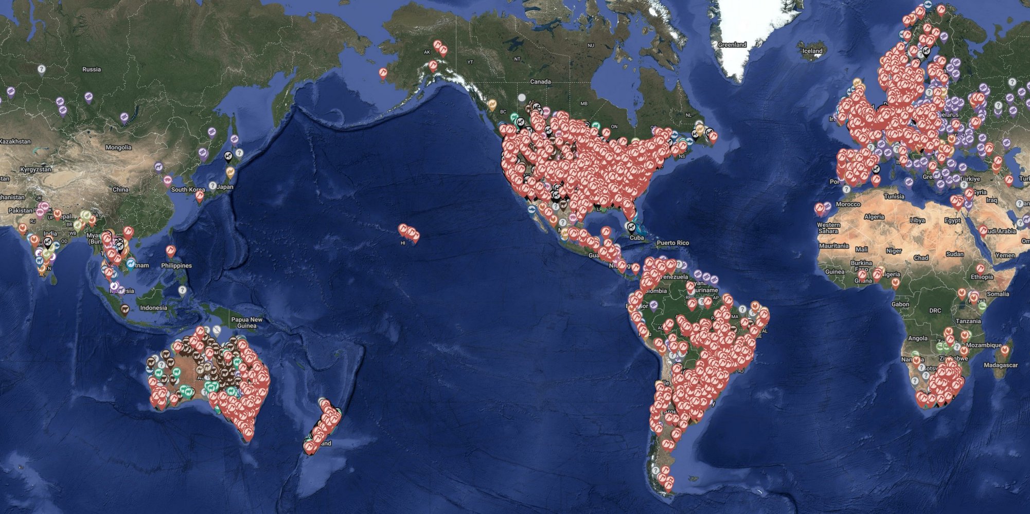
The Farm Transparency Map, an interactive online map identifying the locations of thousands of factory farms, slaughterhouses and other animal exploitation facilities across Australia, has now expanded globally with over 76,000 facilities already marked.
When it was launched in January 2019 by animal protection organisation Farm Transparency Project (then Aussie Farms), the map sparked unprecedented backlash from the animal agriculture industry and its political and media allies. Federal Agriculture Minister at the time, David Littleproud MP, declared it to be an "attack map" and spearheaded a campaign to get the map taken down, with new legislation enacted and sustained harrassment of FTP's founding director, Chris Delforce, and his family. The campaign was unsuccessful.
Delforce, who spent 8 years developing the resource before its launch and has continued to refine and improve it in the years since, says of the expansion: "Six years ago, the Farm Transparency Map ushered in a new era of forced transparency, with thousands of facilities that exploit and abuse animals for commercial gain publicly mapped for the first time. The industry went into a hysterical meltdown, terrified of being so prominently catalogued for all to see after decades of comfortable secrecy."
"Outside of Australia, though, the same industry has escaped this level of scrutiny - until now. The days of hiding out of view, and misleading the public about the enormous scale and merciless, barbaric nature of its operations, are over."
"This is more than just a map - it's knowledge. We believe that knowledge is the most powerful asset available for preventing and relieving the suffering of animals. Through knowledge, consumers are able to form independent opinions, and are able to act. Beyond the individual, it allows us as a society to have informed conversations about commercialised animal cruelty."
Using publicly available information such as directories, databases and reports, as well as the knowledge and expertise of generations of animal advocates, the map identifies the locations of businesses which are engaging in animal cruelty or exploitation, including piggeries, poultry and egg farms, feedlots, dairies, slaughterhouses, knackeries, rendering plants and saleyards, as well as breeding, research and entertainment facilities.
Users are encouraged to submit additional locations, or upload information, photos and videos pertaining to already-marked locations, culminating in the largest crowdsourced tool for animal protection and consumer awareness ever created.
